Unlocking Efficiency and Opportunity through the Power of Aerial Intelligence with Geomapic Vertical
Empowering you with the highest quality of aerial perspectives to provide invaluable data and insights without the hassle of site visits.
Benefits
High Resolution Aerial Photos and Maps
Gain valuable insights, save time, and lower costs with the power of data and UAV Technology
Effortless Access
Instant access to high resolution aerial photos across Malaysia on demand
Up-to-date Data
Access current, real-time aerial imagery
Streamline Planning
Streamline decision-making with easily accessible, aerial intelligence
Reduced Costs
Minimise operational expenses by eliminating travel time and minimize physical site visits
Smarter Decisions
Make data driven decisions based on accurate up to date aerial data insights
Enhance Safety and Convenience
Monitor the progress of projects remotely from your desktop remote projects, infrastructure development, and large-scale operations in real-time
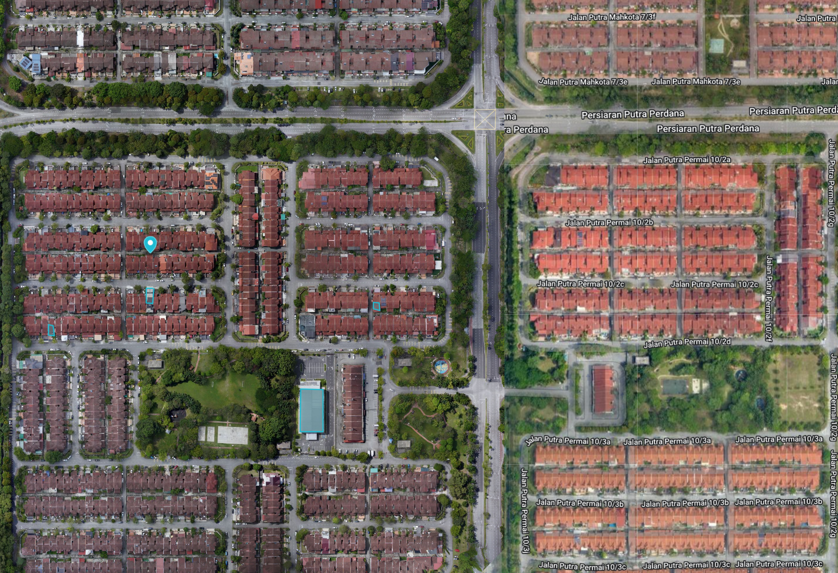
See it Clearly, Decide Confidently: Superior Aerial Imagery with Geomapic Vertical
Conduct virtual site tours from the comfort of your desk. Identify potential opportunities, facilitate client communication, and gain a comprehensive year-round perspective. Our on-demand, high-resolution aerial imagery surpasses the clarity of recent satellite photos, empowering you to make informed decisions based on a true representation of any area.
May 2022 | Selangor, Malaysia
Aerial Maps with unparalleled clarity
Geomapic Vertical provides unparalleled image clarity (3"-10" resolution) surpassing the capabilities of satellite imagery. This enhanced level of detail empowers you to make informed decisions based on a more comprehensive view of the property
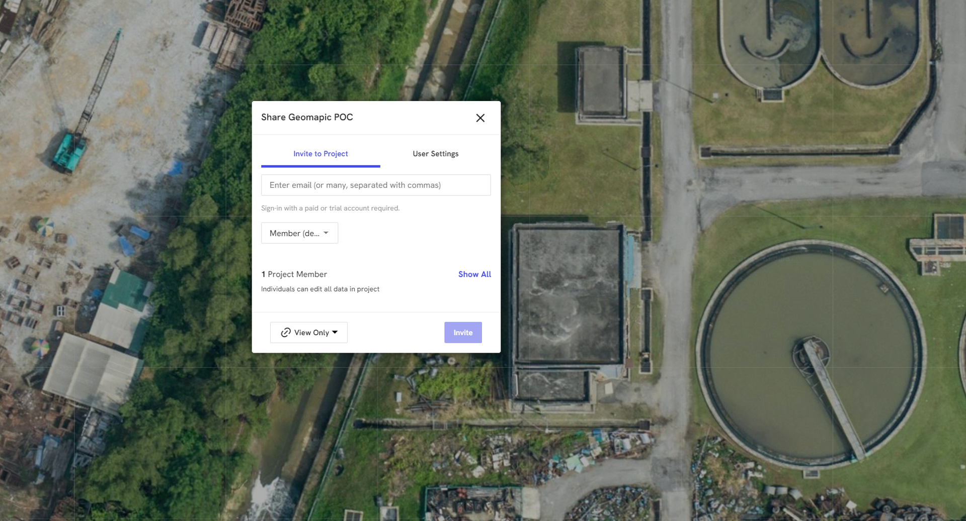
Streamline Collaboration: Seamless Data Sharing for Informed Project Decisions
Leveraging industry-standard platforms like QGIS, Supermap, and DroneDeploy, we facilitate seamless sharing of high-resolution imagery and detailed geospatial data. This ensures clear communication and fosters a collaborative environment where all team members possess a comprehensive understanding of project locations.
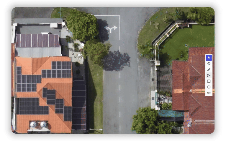
Measure with Ease
Our intuitive tools enable rapid measurement of lengths, areas, and other key dimensions directly within the platform. Additionally, the ability to share findings with clear visuals and annotations facilitates seamless project collaboration and ensures project organization. Leverage the Projects feature to streamline teamwork and enhance communication.
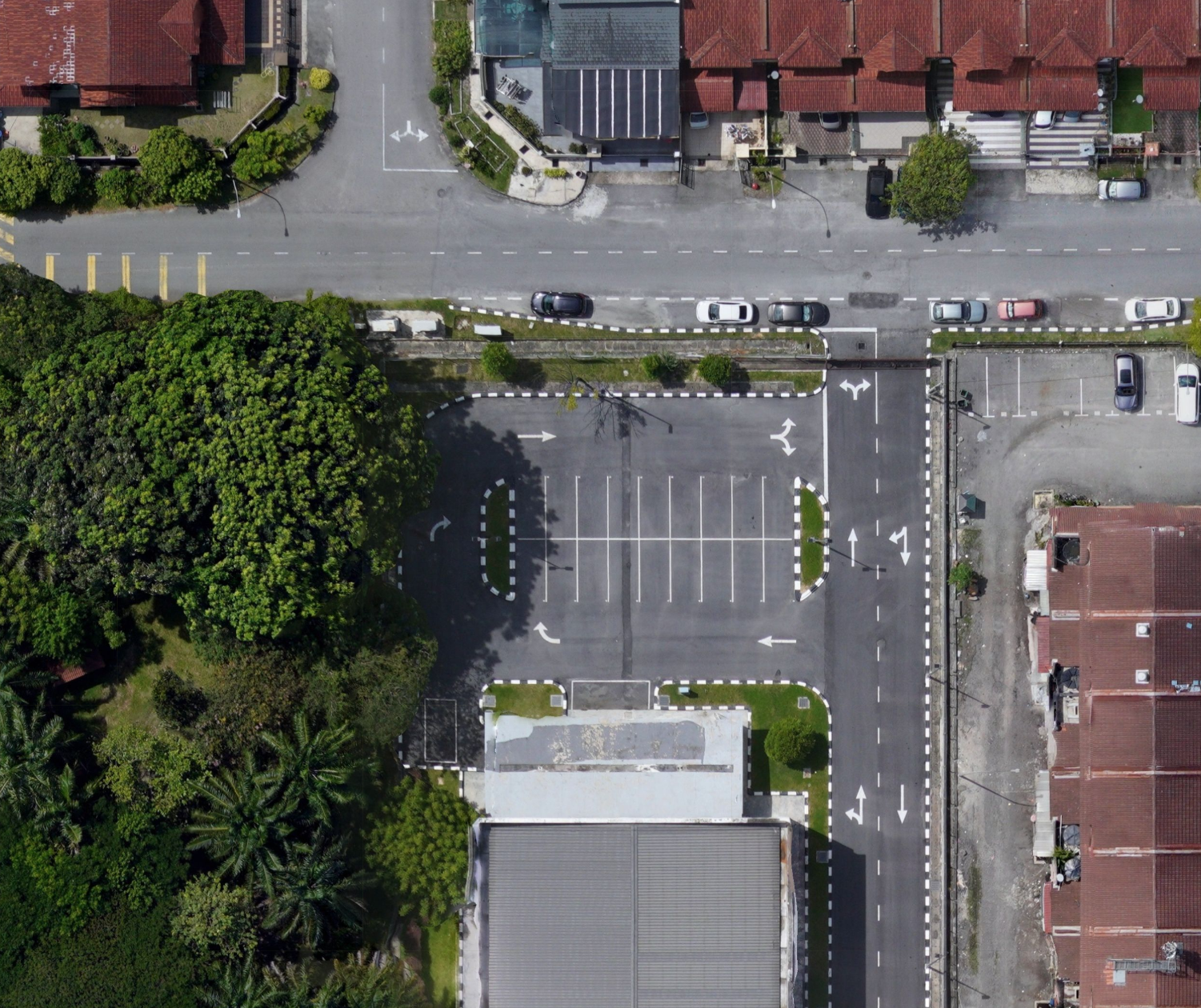
See Malaysia, Now and Then
Explore the places where most of Malaysia lives and works. With our collection of past and present photos, you can see how places have changed over time, giving you a deeper understanding of the area’s development.
It's the strategic use of drones, satellites and advanced software to capture, analyze, and interpret aerial data. This data offers powerful insights that traditional methods simply cannot match.
Trusted by
Trusted by
Discovering location intelligence, one layer at a time.